Maps
The OpenNet Initiative provides multiple filtering maps to serve as graphical representations of our research.
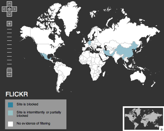
 Our main filtering map is an interactive feature that depicts the states and regions where each type of filtering ONI studies is most prevalent.
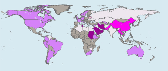
 Our social media map serves as an easy visual guide to the states and regions where filtering of five major social media sites — Facebook, Flickr, Orkut, Twitter, and YouTube — occurs.
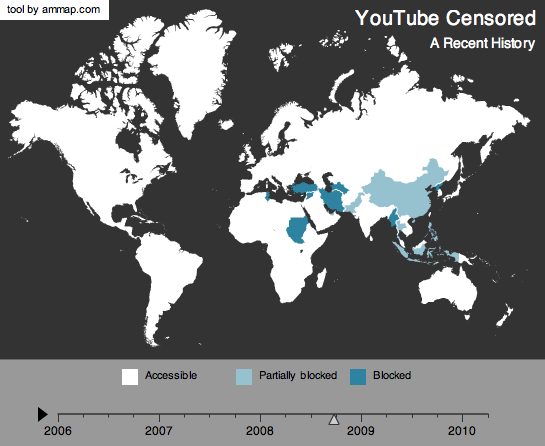 For a detailed look at when and where YouTube has been filtered since 2006, check out YouTube Censored: A Recent History, ONI's interactive global timeline.